Day 75 ~ Sunday, August 16 - We are currently camping at Hi Country RV Park in Whitehorse, Yukon Territory, Canada. Now, it's Sunday and we slept in until 8:00, had a quick shower and decided to do one last load of laundry to try to get rid of the germs. We listened to an old Ronald L. Dart Bible study recording and ate breakfast while waiting for the laundry to finish. What a nice way to start the day.
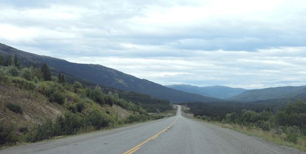
We checked out of the campground and are back on the Alcan highway and heading east toward Watson Lake, Yukon Territory. We're going to stop at the Signpost Forest again to see if our sign is still there – just a reminder, Matt, that we need a new sign – no pressure though. Then, we're taking a different way south to Prince George. The Cassiar Highway that we took north is beautiful and we saw lots of animals there, but we want to take the Alcan all the way to Dawson Creek to say that we traveled the entire length of this road. After all, American soldiers built this highway with the help of Canadian civilians even though the original roadbed is buried below the one we're on. The road is decent here and we're traveling at 100 kph (around 65 mph) which is the speed limit. Canadian pick-ups pulling trailers are passing us on double yellows like we were standing still. They don't seem to care that if they miss-judge and hit an animal or on-coming car, they will take us with them. There's no shoulder here and nowhere for us to escape. We could bump up our speed, but the road can turn rough quickly and we're not familiar enough with it's quirks. The locals will just have to be more patient with us.
We stopped at Johnson's Crossing for gas and met the nicest couple from BC, Chris and Sue, who will be traveling our route for a couple days. They are on their way home to Fort St. John, B.C. and gave us some insight on places we will visit. They also mentioned a butcher shop back in Whitehorse that has their own smokehouse and sells bison, caribou and reindeer sausages as well as the fresh cuts. We missed it. We bought salmon jerky and potted salmon treats but there's nothing that can compare with blueberry reindeer sausage. We'll have to continue to search.
We're back into scenic vistas following alongside the large, long Teslin Lake in the valley with hilly mountains on both sides of us. The road is good and we have a bit of shoulder again for safety. We have mostly overcast skies and only a few patches of blue and the temp is a comfortable 63*. I'm glad we topped off the gas tank because the service area we just passed says they are closed for the season. It's only August 16th!
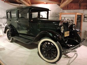
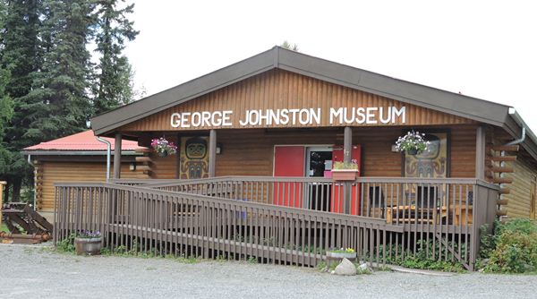
The George Johnson Museum in Teslin is a good one – small enough to keep our attention and big enough to have exhibits of interest about the Tlingit (pronounced Clingit) Tribes. George was a Tlingit who bought an automobile in Whitehorse and had it shipped to Teslin. It was the first auto in this area – a 1928 Chevy AB, but there were no roads. Undaunted, he and a friend built 3 km of road and he charged people $1 - $2.00 for a ride depending on where they wanted to go. He was a First Nations entrepreneur! The original car was shipped back to Whitehorse and refurbished and repainted by the original dealership. George had put a new coat of white house paint on it every 6 months to make it blend with the snow so it wouldn't scare the animals. His paint was quite thick and they had difficulty determining the original color. The rest of the museum is devoted to the handcrafts and customs of the Tlingits. It was a very interesting place dedicated to a very interesting man.
Back in the truck we go and the overcast skies have turned into a very light sprinkle – not enough to wash the windows, but we know it's there. The heating coil must have a pinhole leak because we smell antifreeze and the windows fog when we run it. Actually, we've been dealing with this for a couple weeks but it only is a problem under certain conditions. It takes just the right temperature and humidity and it seems the right elevation to be a problem. We'll get it repaired eventually.
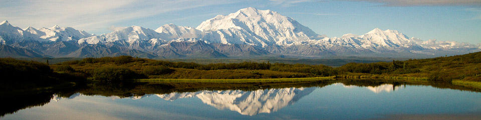
We're surrounded by far-away mountains here and the ones ahead of us are spectacular. They're old mountains with rounded summits and we can see lines of different ridges. The closest ridge is dark and they lighten as they recede in the distance. We're back in British Columbia for the next 20-30 miles and we'll be close to the Yukon and British Columbia border all day today. The spruce forest is tall on both sides of the road and the Fireweed is just going to seed here. The light fuchsia blooms are gone but the deeper magenta stems and white, seed puffs bring the roadside into beautiful color and they're mixed in with large patches of white daisies and white yarrow. Can you tell that its Diane typing now and not Alan?
Alan's bit of a cough has turned into a deeper, dry cough. Menthol cough drops help and Benylin every six hours is all we can do here in Canada. If it gets worse, he'll have to get medical attentions.
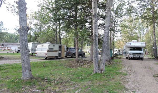
We've been talking about the Yukon and BC parks. If you don't need electricity, water or sewage conveniences, the government parks are the best places to stay. They have the choicest land and the best scenery (much like Michigan State parks) AND they're usually cheap at $12 to $15 per night Canadian. We prefer these parks for 1 or 2 nights and then stay in a private campground with all the bells and whistles. But we've also found that nice, clean, newer campgrounds are few and far between. They're mostly old, ill-maintained and over-used even at $40.00 per night. Some charge an extra $1-2.00 for 3 minute showers and one even charged to fill up the water tank. Camping is not inexpensive anymore, but staying in motels is out of the question. Dumpy motels are $80-$100 per night and I wouldn't want to even stay there. We're better off in our little trailer where I know when the sheets were last washed. I'm not a prissy person, but I have my limits.
We're going up, up, up toward the Continental Divide again. The rain that falls here will either run to the east or west. East goes into the Liard River which joins the McKenzie River heading north into the Bearing Sea – not all that far from Prudhoe Bay at the end of the Haul Road. Rainwater going west will run into the Teslin River basin which joins the Yukon River west into the north Pacific.
An accident! There is a small, red car on its side in the ditch about 20' below the road. A man and his 4 year old daughter are out of the car and lying against the side of the ditch. He is holding her. We have to stop. He had abrasions on his arms and she complained that her neck hurt. Our cells don't work in Canada at all – no communication. We got blankets to keep them warm and flagged down a trucker – no communication device with him – and then a pick-up with Yukon plates who fortunately had a Sat phone. The police were called, but the man and his daughter took a ride with the trucker into Watson Lake for medical attention. The truck had a bed in the cab so she could lie down. We stayed with the car for a bit and turned off the flashers. Our chosen campground is only about ½ mile further, so we parked there and watched for the police. His car-top carrier had detached and landed 30 or so feet in front of the car. It was broken open and tools were strewn all over. We wanted to be sure no one vandalized the area. It would have been easy pickings. We had arrived around 5:45 pm - about 5 minutes after it happened. He was driving west and said he was avoiding an on-coming vehicle in his lane. There were no skid marks and he was the only vehicle there. His windshield had broken in two places and both air bags had deployed. He said she was wearing a seat belt. There was no child safety seat in the car. We said a quick prayer for their recovery.
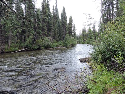
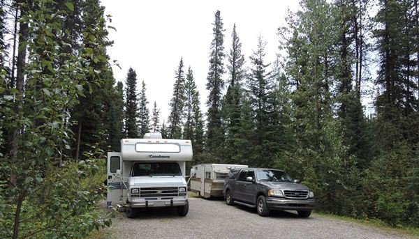
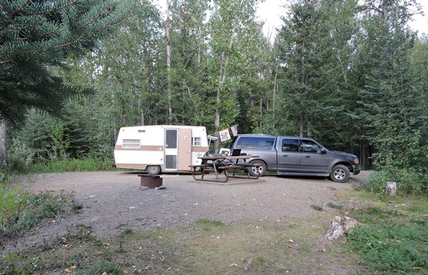
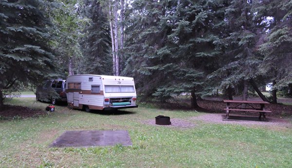
For twelve bucks for the night, our chosen campground was the rustic Big Creek Territorial Campground about 40 miles west of Watson Lake, Yukon. Great choice, again. Quiet, except when we run the generator. Our campsite is a double-wide with room for both trailer and motorhome. We are about thirty feet from the creek which we can't see, but we can hear it. We ate dinner and went to bed early; lots of driving today.
This is Big Creek Campground and by golly there's a Big Creek in back of our site.
The temperature went down to 49 degrees last night with partly cloudy skies.
Day 76 ~ Monday, August 17 - This day started very nice with 60 degrees and sunny skies at 10:30 am. My cough problem is much better this morning mainly due to the medication. So be it. We have quite a drive planned after I run the generator to refresh the refrigerator and eat some breakfast: bagels, cream cheese, yogurt and a cup of tea.
Big Creek Territorial campground is a rustic, but lovely place to spend the night. The Big Creek certainly lives up to its name as it was at least 20 yards wide and maybe 2 feet deep. It was fast moving too and chilly. I didn't put my fingers in since I've caught whatever it is that Alan's been fighting for the last couple days and was chilled when I went to bed last night. We slept in until 9:00 so we must have needed the rest.
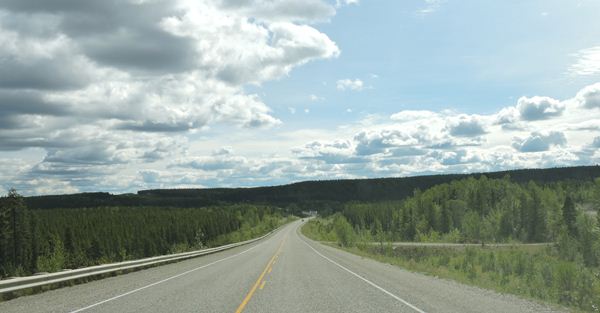
So back on the road heading east we made a quick stop in Watson Lake for more cough medication and said good-bye to The Yukon Territory. We've been warned that there is a Wood Bison herd ahead that likes to camp out on the highway – no sign of them yet. We have mostly sunny skies and 69 degrees and are in spruce and birch forest again. Some of the birch are tipped with golden yellow leaves. Already? The road is blacktopped and smooth with wide shoulders and is sometimes built up 50 feet from the surrounding ground. We believe that's to counteract the effects of permafrost heaving.
Have I mentioned all the ravens here? They're everywhere and very large birds. They should be the Alaskan or BC or Yukon official bird. We're passing lots and lots of picturesque small lakes and the mountains are dead ahead. The on-coming vehicles are mostly motor homes, trailers, fifth-wheels and oddly enough, lots of pick-up campers, but not many single cars. The pick up campers are quite common here. In Michigan you see very few anymore and we thought they quit making them, but they are popular here with Yukon, BC and Alberta plates. This road is nice with no vehicles in sight. We haven't seen a vehicle in eons and no homes or even cabins – just trees, road and sky and the wide Liard River. We're in the foothills now.
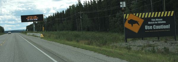
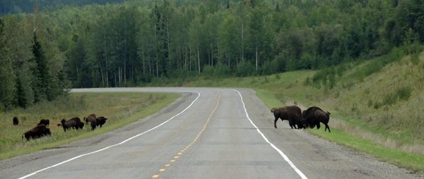
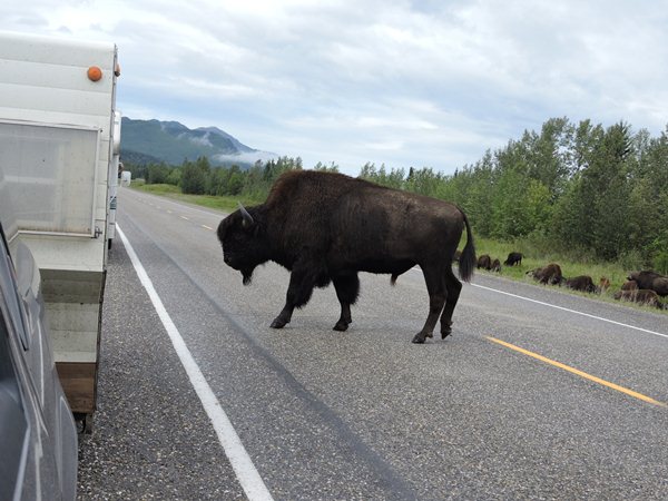
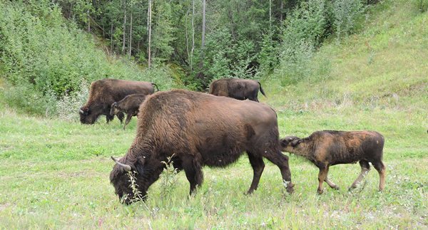
Our first Wood Bison was sighted around km 838 heading south on Hwy 97. There are supposed to be more. Another herd of one at km 826 and yet another herd of one at km 793. Just teasers for us - there's supposed to be a herd! Okay, now we're talking! There are at least 36 bison hanging out at the next sighting just 2 km to Liard Hot Springs where we plan to spend the night. There are 4 vehicles on the side of the road taking pictures...including us. There are young bulls practicing butting techniques and calves nursing and one large bull taking a sand bath. It seems strange that an animal that large could roll around like a dog with all his feet in the air. This is fun to watch and may be the highlight of our day.
All right, where the heck are we? Are we in the Yukon Territory on highway 1 or in British Columbia on highway 97? We don't know because about eight miles east of Watson Lake, YT, we crossed the border going south into BC and passed a large sign that said "Welcome - British Columbia - The Best Place on Earth". Now, there's a personal opinion for ya. Anyway, we continued our drive across the border and the highway changed from 1 to 97, happens all the time. A check on Google maps confirmed this number change. We then drove about 27 miles eastward and then north toward the YT border. In the next thirteen miles or so, we crossed the border six more times, north and south, and never saw a single "Welcome to YT" or "Welcome to BC" sign again. Check the map; it's pretty crazy! Canada is very light on their road signage. Keeps you guessing. It's a need to know thing and we didn't need to know. In fact, at the time, we didn't even know we were in and out of YT and BC so many times in such a short distance.

Hello Buffalo
This video is27 seconds long
without sound
What do buffalo do during the day you ask? Walk around, eat, butt heads, eat, walk across the road, eat, and then poop.
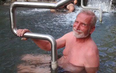
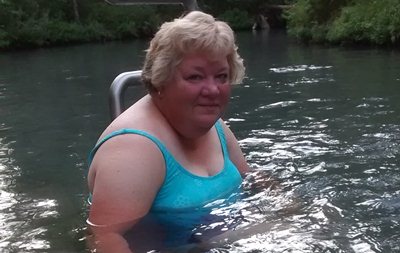
The Liard River Hot Springs sign comes into view and we are excited. Hot Springs and a campground in the same location run by British Columbia Provincial Parks. We picked out a nice site close to the wonderful pit toilets. Yep, rustic again and this time it cost us $26 for the night; most expensive for a rustic, but this includes admission to the hot springs which Diane and I couldn't pass up. The 100 degree plus springs flow up from down under thru a pile of rocks and across a pool area and disappear to who knows where. The water is flowing at a pretty good clip so it is clean, hot and oh so relaxing. Much better than the hotel hot tubs that have whatever floating in them or the guy next to you with a relieved look on his face. Alan's joint aches and my chills are gone for the time being.
Those are NOT my bubbles!
We had to walk about a half-mile from the campground to get to this warm water pool.
I would sure like to have one of those concrete picnic tables.
We had soup and a small sandwich for dinner with a nice cup of tea with honey. Diane went to bed at 8:40 pm due to her discomfort with the head cold thing I may have given her. The drugs also helped with the sleepiness. Booze helped me. Good night.
It is 56 degrees outside at 10:00 pm Pacific time with overcast skies.
Day 77 ~ Tuesday, August 18 - It rained last night. A light rain that continues this morning with a 57 degree temperature. I slept 12-1/2 hours last night! Between the cold and the hot springs and the meds, I was done in. I feel more alert this morning. We're heading toward the big city of Prince George, BC which means electricity, internet and showers, but also traffic - mixed blessings. Today will be mostly a driving day to eliminate some miles, but it'll take probably 3 days to get to Prince George.
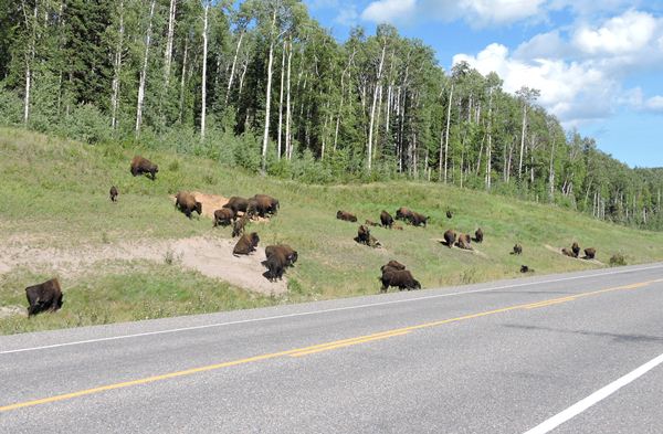
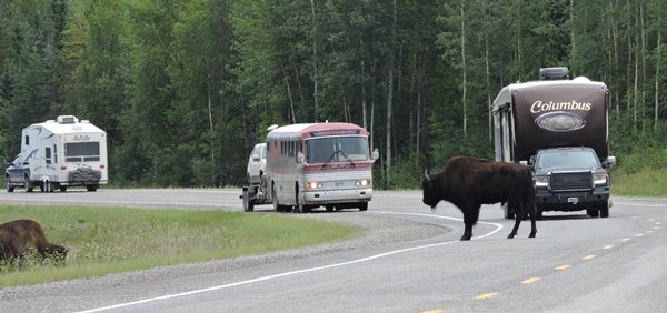
Just a few km on the road and across the Liard River bridge, we came across another Wood buffalo herd – about 50-60 animals – which stopped us in our tracks for picturating. These are big boys and gals with babies. They are fascinating and we spent over forty minutes watching them. Fun, but it's time to move on.
Butt Head Buffalos
This video is94 seconds long
without sound
These two guys are really getting into it.
The Buffalo Do Roam Video
This video is 4 minutesand 33 seconds long
It may take a few seconds to download.
There are about thirty buffalo on both sides of the highway grazing and walking back and forth across the highway heading eastward toward the nearest Dairy Queen.
Buffalo Bath
This video is 4 minutes longTaking a dirt bath and other things that buffalo do.
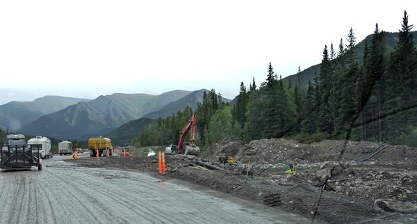
Now, we're into the mountain pass and have construction again. These mountains are not made out of granite or large rock of any kind. They're sandy gravel and I don't know how they stay in one place. The construction has exposed entire facades of the mountains and these babies have nothing to hold them together. An avalanche would take out the roadbed quickly. We can see men working ahead and we're stopped to wait for the pilot car to lead our convoy through on one lane.
We have a light sprinkle and 64 degrees. Just as we had anticipated, there was a landslide that took out the road. They've built a by-pass and are reconstructing the original roadbed. This is wild country. We would expect to see bear but the construction has created a huge mess. They've cut out 100 yards width along the entire stretch. I doubt they'll be done before the snow flies. This is a massive project. We've driven 5-6 km and our trailer is full of mud again. The end is in sight. That was about a 10 mile stretch of yuck.
Further on, the area reminds us of the Smoky Mountains on a bigger scale and the road has deteriorated a bit - narrower, smaller shoulders and bumps and dips again. It's too hard to type and keep the computer on my lap - I'll continue later.
We're driving through the beautiful Muncho Lake area but probably will not stop today. We're in a steady light rain. We can see alluvial fans where glaciers dropped rock on their retreat. The spruce are stunted again and the birch are sprouting reds and yellows. Fall comes early here. Muncho Lake is long and wide and lovely with turquoise water filled with glacial silt. We haven't seen bicycles, but today was the day to see critters. First the bison, then a moose munching away knee-deep in a small lake and then several young caribou swimming across the river and goats as well as the ever-present ravens. The skies are clearing as we continue through the mountains toward the Toad River Lodge with its World Famous Alaska Highway Hat Collection. I kid you not. Everything here is World's Best or World Famous or World's Largest. They need tourists to stop and spend their dollars. Their season is very short.
The mountains have changed a bit to green, green, green reminding us of the curvy dips of the back roads in Tennessee – no ledge rock though. The grass is almost a lime green and striking against the dark spruce. There was a bit more construction although nothing was being done – mostly sitting. We should have invested in mud flaps on our truck. With all these gravel roads, our little trailer is taking a beating from our own truck!
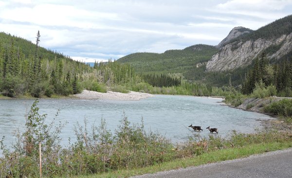
Deer Crossing
This video is22 seconds long
Always travel in pairs; especially when crossing a river.
Every turn seems to bring new and varied landscape. We've traveled through what looks like KY, TN and NM/AZ with buttes – flat topped mountains – only green with the trees here. Long, wide, lush valleys and farms and horse ranches are all mixed in with hilly mountains and curvy mountain passes. God certainly blessed BC with beautiful and varied scenery as we go up, up, up and down, down, down through many mountain passes and through two more long construction zones – total of 4 long ones with pilot trucks and 1 shortie. Lots of maintenance on this road. I suspect they do this every year.
Fort Nelson will be our target today although, looking thru all of our literature, I haven't found any campgrounds in that area. We'll watch for signs. There aren't any attractions either. Nothing to see, nothing to do. Maybe well take a picture as we drive away.
Just short of Fort Nelson is that sign for a campground "Next Right", so we pull in. Kinda pricey and a real dump, but we'll call it home for the night. Triple G Hideaway Campground is the place with free Wi-Fi that doesn't work, just like most of the free Wi-Fi in the other Canadian campgrounds. Big joke. They do have rather large, shady pull-thru sites, but the worst restrooms ever. Dump. The whole place is extremely old and in dire need of maintenance. But, it does have a restaurant which is also a dump. They should change their name from Triple G to Triple Dump.
We ate dinner outside on the twisted and warped plastic picnic table and I beat Diane in a game of cribbage. Diane quit early tonight. She is still fighting the head cold thing and feels tired. A small glass of Jack Daniels is chasing my blues away. Our road trip today was one of the most scenic drives of this trip. On that note, I say Good Night, Irene, Good Night.
It is 62 degrees outside at 10:00pm Pacific time with cloudy skies.
Day 78 ~ Wednesday, August 19 - This is Diane typing and just so you know, I am really angry this morning! We paid $42.00 for this campsite and although I'm usually optimistic and overlook a lot, I must agree with Alan that Triple G RV Park in Fort Nelson is truly a dump! I finally felt good enough to be awake and clear-headed at 5:45 am - closer to my normal schedule. So, I quietly got things together to take a shower in their old, ill-maintained and disgustingly filthy restrooms with the outside and inside doors that won't close and latches and hooks that are all broken and the exposed piping, to find that they wanted an extra dollar to take a 3-minute shower! Aargh! I could really use a shower since I've been fighting chills and fever for 2 days, but I won't get one today. No sirree. I'm disgusted. This campground charged $42 for one night and they don't even tell you there's an extra charge for showers! Why not charge $45, why not $50 and give you a token? And it's such a rude way to awaken! It sets up your whole day. It's because of this little slap that I will not willingly camp in Canada again. Too bad, but we've often felt that we are being simply tolerated and not welcomed. Too many times, we've not been offered the exchange rate and only offered dollar for dollar on American money. We got Canadian money but how much will we need? Many campgrounds will not take a credit card and even the Provincial Parks claim they don't know what the exchange rate is! If the Canadian dollar was worth more than the American dollar, you better believe they'd know the difference and to make matters worse, they smile as they gouge you! Too many times these things have happened. I'm not talking once a week; I'm talking 4-5 times a week! It's the little things that build up and get under your skin. I'm not asking for special treatment; I'm asking for FAIR TREATMENT and clean facilities! Why are campers treated as second class citizens? I can't wait to get back in the lower 48. I'm soured on this mentality and I'm soured on Canadian campgrounds! I'll take pictures of the restrooms so you know I'm not kidding when I say it's a filthy dump with clumps of rotting hair in the corners and drains clogged who knows what. AND the Wi-Fi DOES NOT WORK for the umpteenth time! I'm really ANGRY! The health department should close this place down. They operate a restaurant here too; I'm so very glad we didn't eat dinner there! If their restrooms look like this, what does their kitchen look like? Anyone that knows me, knows that I can take a lot of abuse and look the other way. It takes A LOT to get me to this point, but I'm DONE! The sooner we're back in the states, the happier I'll be.
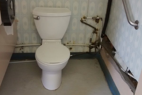
This place is a filthy dump.
We left the world's crappiest campground about 10:30 am and headed south on the Alaska Highway (BC97). The temperature was about 62 degrees and the skies were partly cloudy but looked promising. A gas tank fill-up was in order in Fort Nelson which is a nothing town with no attractions whatsoever. We did stop in the Visitor Center to grab more info on the upcoming journey down to Prince George. We had only a couple of planned stops today, so off we go.
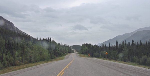
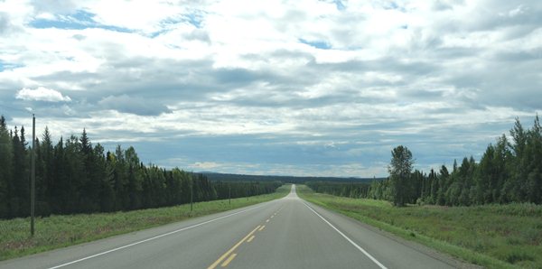
It is a very easy drive south thru the British Columbia countryside. The terrain is rather flat with short mountains always in the distance. The road is very good with only a couple of short gravel sections and no real construction and no animal sightings to slow us down. The speed is pretty much 100 km per hour (about 63 mph) and the traffic is very, very light. This section of Highway 97 is not tourist friendly at all. Not a single rest area for over 200 miles and no viewing areas. There's nothing to view, just trees, wildflowers and the hilly mountains on the horizon. Very nice, simple landscape; once again, like a drive thru upper Michigan. The whole drive today from Fort Nelson down to the wooden bridge was like this. Simple and somewhat scenic.
The last couple days' driving forced us to go thru the small towns of Fireside, Skooks Landing, Coal River, Muncho Lake, Toad River, Muskwia, Prophet River, Trutch, Sikanni Chief, Pink Mountain, Buckinghorse River, Wonowon and Charlie Lake. All cool names for itty bitty one-building towns. Don't blink.
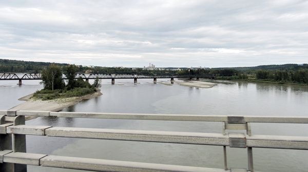
What wooden bridge?, you ask. Well, the Alaska highway was built in 1942 and took eight months to complete. It took nine months to build the Kiskatinaw Bridge over the Kiskatinaw River. Built by a Canadian company, this 190 foot long wooden trestle bridge is curved with a 9 degree pitch, is a historic site, and is still in use today. It is located on the old Alaskan highway at Mile 21 and gets only a few cars per hour. Pedestrians are encouraged to walk the bridge and take pictures, which we did. It is a real engineering wonder being preserved by the Canadians. Very cool.

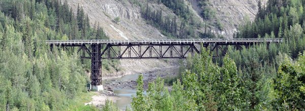
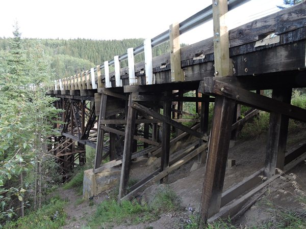
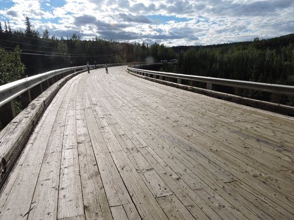
It's not the picture - this bridge really is tilted, 9 degrees.
Kiskatinaw Bridge and River
This video is 1 minuteand 16 seconds long
This bridge crosses over the Kiskatinaw River and this video proves it.
Watch it! Don't get run over by all the traffic.
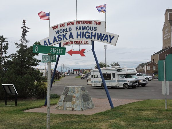
There are a few things that were very important to me to see and touch on this Alaskan trip. One is the pipeline, which we saw and touched. Another is the Alaskan highway that the U.S. built during WWII to get supplies to our troops in and out of Alaska to keep the Japanese out of our country. Watch the historic movies on the building of this highway. A very good watch. We want to travel the entire length of the Alaskan highway and we only have about 21 miles to go to Mile 0 in Dawson Creek. The other end of the highway is in Fairbanks. We've traveled it all, almost. The Alaskan Highway is an engineering feat that all Americans should be proud of. Of course, the entire highway has been improved and upgraded into what I think is a pretty darn good highway today from start to finish. The Canadians do a great job in the maintenance. Thank you Canada for that.
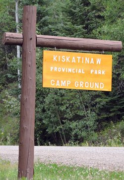
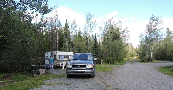
Our final destination campground for today was yet another rustic British Columbia Provincial park named after the river, Kiskatinaw, for 18 bucks for the night. This park is right next to the bridge and our site is on the river that runs under the bridge. Another river site! We went for a walk down to the river and threw stones. Fun. It is very sunny and a pleasant 77 degrees at six o'clock. It promises to be a great evening, but first I need to run the generator to refresh the refrigerator after the seven-hour drive. We need noise to keep the bears away. Some Rum and Coke with dinner and early bedtime capped the day. We'll sleep well tonight.
The sign says "Camp Ground", not "Campground". The Canadians are strange.
It is 60 degrees outside at 9:00 pm Pacific time with partly cloudy skies.
Day 79 ~ Thursday, August 20 - The skies are overcast with 62 degree temperature. Looks like we are in for some rain today. Our stay here in Kiskatinaw Provincial Park was quiet and peaceful as all of these Provincial parks are, but we have to leave.
Yesterday, we had to take a short detour off highway 97, the Alcan Highway, to get to this park by the bridge. Today, we are driving back to highway 97 on the same road so we won't skip any of the Alcan Highway. We are now traveling south on highway 97, the final stretch of the Alcan and heading into Dawson Creek, British Columbia, Canada. We're out of the spruce forest and into rolling farmland – wheat and horses – small ranches. We passed a HUGE pile of logs – at least 30 logs wide and probably 70' high and 2-3 football fields deep. “What are all the logs for?” you might ask. We have no idea. They have a lot of trees here, why piles of logs?
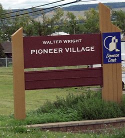
We are now into Dawson Creek and we just had to stop at the Walter Wright Pioneer Village, a good outdoor museum area with lots of old-timey buildings and log cabins outfitted appropriately with everything imaginable. There were lots of old tractors and farm equipment parked around the buildings. Very well done. The admission was very reasonable, like five bucks or something.
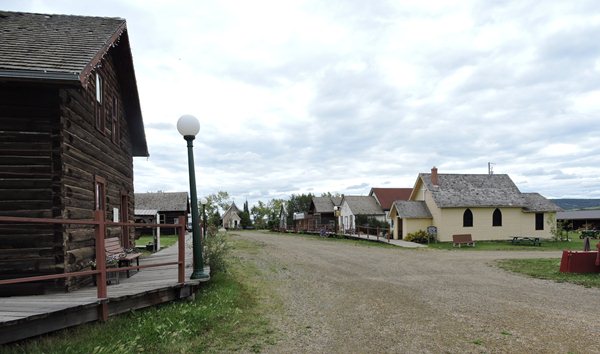
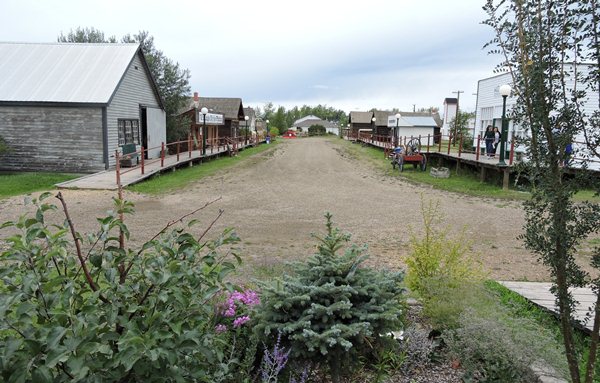
The insides of all the buildings were loaded with antique furnishings and old junk.
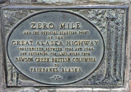
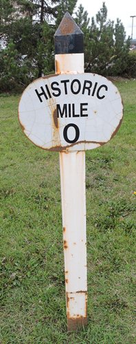
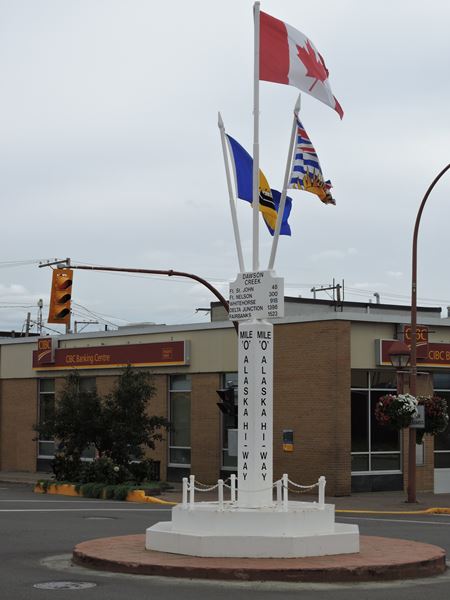
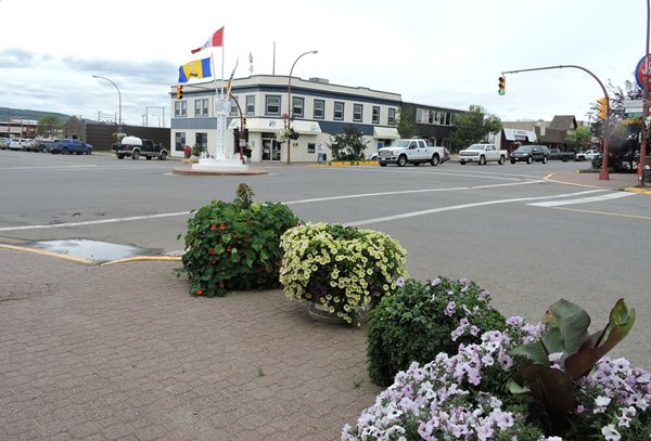
We finally made it to Milepost 0 of the Alaskan Highway in downtown Dawson Creek and took pictures of several signs denoting the area. We can now officially say that we have traveled the entire length of the Alcan. Do we get a star on our foreheads now? We got pins instead.
I've been saying for the past few months that the U.S. should have commandeered British Columbia, Alberta, and the Yukon Territory when we purchased Alaska way back in 1867. Think about it - three more states, no passports required, a nice 2400-mile long interstate freeway from Seattle to Fairbanks with rest areas and mile markers, no money exchange rates and none of that goofy-looking money, no kilometer signs, no liters of gas, no stupid French signs. Rename British Columbia to Klondike, a good rough and tough name. Yukon can stay, it's a cool name. Alberta? Come on. What a prissy name is that. Rename it North Montana. Tourism would skyrocket.
And then there's Mexico... We have their people, might as well have the land also.
Oh, maybe I'm off subject here. Back to traveling and having a good time.
Since it's a bit brisk today, it's afternoon, and we are hungry, we stopped at Robin's Donuts and Deli for a bowl of hot soup and are back onto Hwy 97 heading toward Prince George where we know that we can get internet hookup. There are more small horse ranches, then back into foothills and birch forest tipped with gold, into a pass with switchbacks and only 335 km to Prince George. We're not going to make it today.
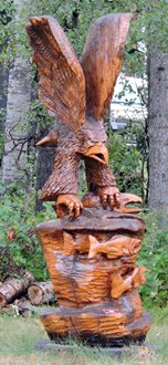
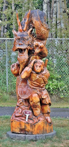
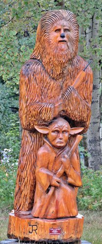
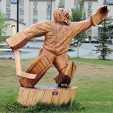
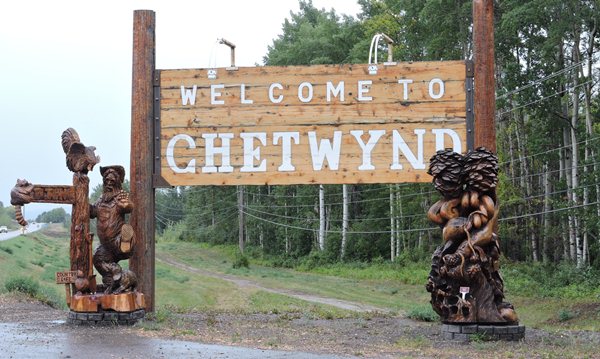
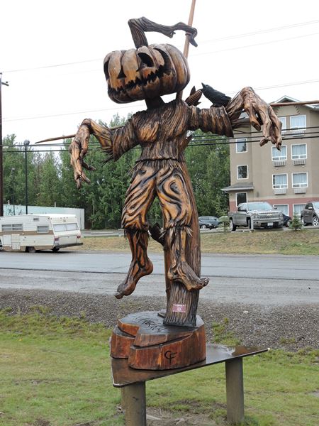
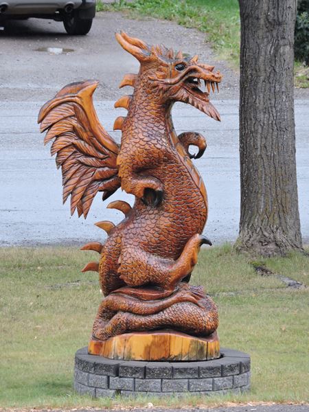
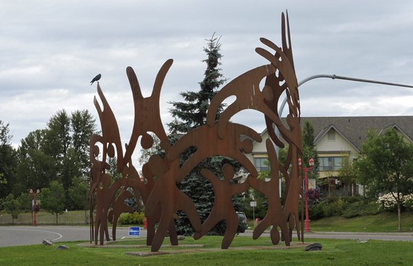
If we had been in this area in June, we would have stopped in Chetwynd, BC for a couple days to watch their Annual Chainsaw Carving Championship that's known worldwide. Today we simply drove through town and took pictures of the many sculptures displayed along the main street – at least 50 of them. Just outside Chetwynd, we were stopped again for construction. There's as much construction here as there is in Farmington Hills. Gregg and Gale took off ahead of us and disappeared down the road.

We're in light rain and can see the low hanging clouds covering the mountaintops with foggy fingers dipping toward the dark spruce forest. It's quite lovely. I've spotted deer and white ibis, but not fast enough to get the camera focused before we pass and the ever-present ravens are everywhere. We don't even count them anymore; they're as plentiful as robins in Michigan. There are BIG power lines sweeping over the road and up the mountainsides and we're climbing. It's subtle now, but we know the routine. Only 256 km to go to Prince George. I can't complain about this road; it's wide and smooth and has decent shoulders. We're clicking along at 100kph. Alan's doing a great job.
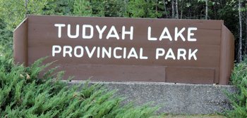
Very heavy rain has slowed us down just west of McKenzie. It's 7:00 and we're still over 2 hours away from Prince George. I don't think we'll make it today. We're both tired and ready to call it quits so we're looking for a Provincial Park to get off the road and there are two not far away. The first one is Tudyuh Lake Provincial Park Campground, another rustic and wonderful British Columbia Provincial Park with the best water pump and water. This is good for the night and the $13 price is good also. Quiet as usual. A good camping dinner inside a high and dry trailer was in order. I'll drink to that. Good night.
It is 51 degrees outside at 10:30 pm Pacific time with heavy overcast skies and rain.
Day 80 ~ Friday, August 21 - We're so glad we pulled into Tudyah Provincial Park when we did because just after we settled into the site, it poured again and didn't let up until after we were in bed. We woke this morning to clear sunny skies with 56 degrees and found we had stayed in a lovely park right on the lake with really good well water.
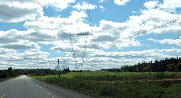
We're back on Highway 97 heading south toward Prince George and I know we'll make it to Bee Lazee RV Park and Campground today. We stayed there on our way north and it's an older, but very clean park. We're in a spruce, birch and poplar forest with lots of lakes and small, grassy wetlands which would suggest moose, but none yet. Only 50 km to Prince George. The road is good – smooth, wide blacktop with wide shoulders and they were painting on the white lines just behind us. There are more trucks along here – mostly logging trucks with trailers hauling 30 ft logs to the mills. We've picked up big electric lines again and there's more local traffic and not just RVs. It is a very nice drive into Prince George, British Columbia.
The weather was so much better than last night's heavy rain. All is well.
We pulled into Bee Lazee RV Park about three o'clock and met Gregg and Gale who made it here last night. Diane has to work today and we need a good internet connection which we know they have. We stayed at this campground on June 24 on our way up to Alaska. This old park is pretty nice with the cleanest restrooms ever and the price is quite reasonable with a Good Sam Club discount. The owners, Lise and Ivan, are very helpful and they have rules - the gate closes at 11:00 pm - just ask them for a key if you'll be out late. Bee Lazee is a nice, clean, Canadian campground. Stay here if you're near Prince George.
Alan drove to the Superstore, which is like a Walmart (but more expensive), in Prince George to procure a couple of sandwiches and potato salad for dinner and breakfast food for the next couple days. It was a very good dinner followed by a rum and coke. The weatherman claims the temperature is going down to about 34 degrees F tonight. We'll be snuggy warm inside with the heater going. Diane worked the whole evening, but still had a bit more to do in the morning.
It is 42 degrees outside at 11:40 pm Pacific time with very clear skies and lots of stars visible.
Day 81~ Saturday, August 22 - Boy, oh, boy, did it get cold last night! Down to 33 degrees. The skies were as sunny as can be at eight o'clock this morning, but quickly clouded over and looking like rain. We just can't control the weather. Diane continued her work and we had to sign up for another day here. Gregg and Gale decided to head on down the highway to the U.S. to get a jump on some sight-seeing. They really need to get back home near the end of the month so Gale can renew medications. We will try to catch up with them in the U.S. where we will have normal cellphone and Wi-Fi communications with our Verizon hotspot.
A visit to downtown Prince George is on our list of things to do later today, so after Diane finished her work, we went on a road trip to see what's happening in downtown PG. Nothing. Really nothing. We checked all of the literature and visitor info and they hype this place up as they need to get the tourist dollars. But, nothing. Nice town with lots of stores. It is the capital of British Columbia, but nothing. Okay, to be fair, not much. They do have a nice railroad museum.
Some jackass politician, Todd Doherty, stuck his political signs (more than one) right here. Idiot with no respect for public land. Stick 'em over there on the neighbor's lawn.
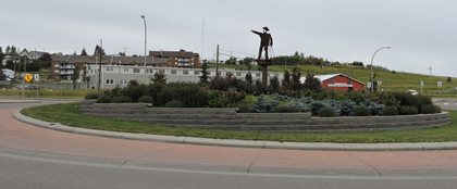
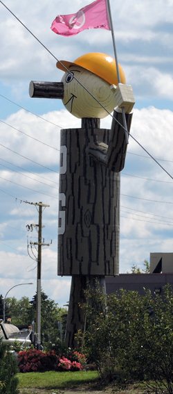
The Mr. PG Statue (pix on the right) is probably the stupidest looking landmark ever. Sorry.
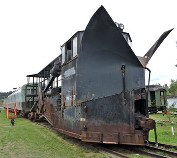
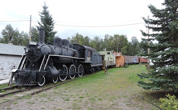
They are real big on museums up here and I am big into railroads so we just had to visit the Prince George Railroad and Forestry Museum just outside downtown Prince George. George Pullman was responsible for the design and manufacturing of the famous Pullman car or sleeper car for the railroad. The museum has several of these cars that are open to the public for a self-guided walking tour. Some of these cars have been restored to very good condition. Others, not in any way and are old and crusty, but very interesting. They also have a few engines, box cars, snow plowers and a caboose. There is a lot of industrial machinery, big saws, etc parked on the premises. None have been restored and are getting rustier by the year. All of this stuff dates back to the first half of the twentieth century. Very interesting place as museums usually are. Railroad stuff is very cool.
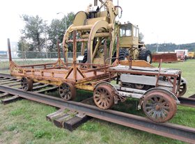
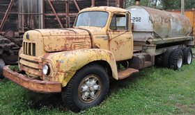
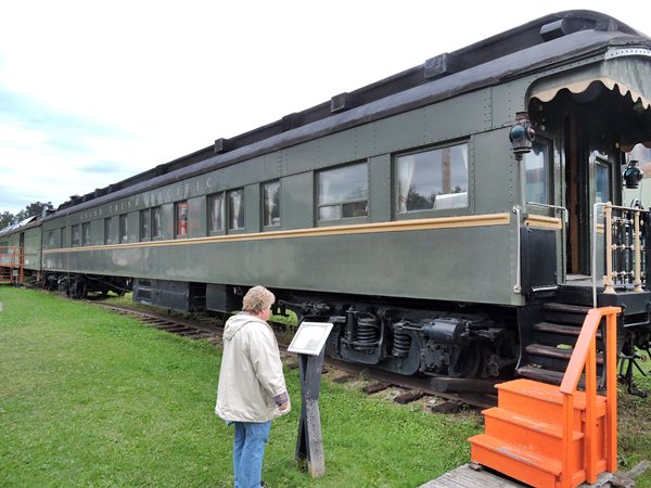
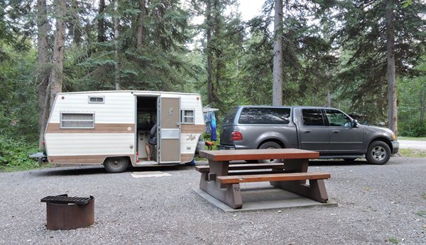
Rich people toured the country in these things. We have an old pickup truck and older trailer.
We had dinner at Boston Pizza - sports bar - that sold a lot more than pizza. The food was excellent. Back at the trailer we had rice pudding for dessert. Yum. End of day and end of week. Good night.
It is 60 degrees outside at 8:00 pm Pacific time with partly cloudy skies. No rain in sight.