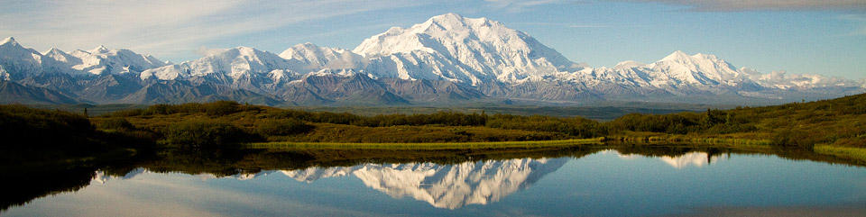
Day 68 ~ Sunday, August 9 - The skies are a hazy sunshine this morning with 60 degrees. We need to leave Dawson City, Yukon Territory, Canada, and start our way back to the good ol' U.S. I love this place and wouldn't mind coming back for another visit, but it is too far to drive; they do have an airport. Hmmm.
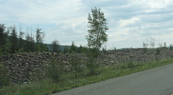
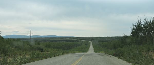
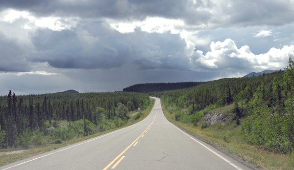
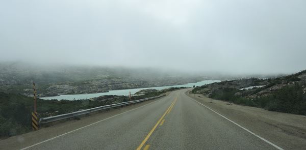
After listening to Ronald Dart for this morning's service, we headed out of Dodge, I mean, Dawson City, east on Highway 2, the Klondike Highway. Not much going on here. The road is blacktop or tantop with patches of gravel to keep you awake and no shoulder most of the way with trees and shrubs growing right up and into the road. We've seen mostly Birch forest (never seen so many) with a couple Spruce mixed in, then we hit patches of permafrost and the scraggly Spruce return or nothing at all. No animals...yet. We stopped at Gravel Lake, slipped across the bridge at Stewart Crossing and looked for ice cream at Pelly Crossing (no luck), so it's on toward Carmack for the night where we've heard from several folks that Five Finger Rapids is well worth a stop and there are several small campgrounds there– 10-20 sites each. Skies were overcast this morning, then clouds and patches of blue sky. The temperature got up to 73 degrees today as we were driving, so it's warm. This is the kind of drive that will put you to sleep.
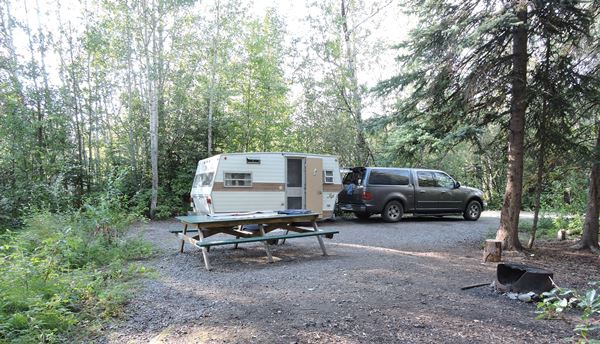
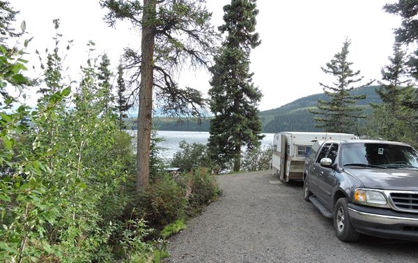
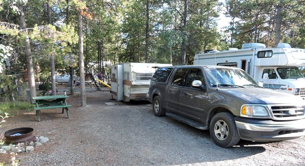
We stopped for the night at Tatchun Creek Territorial Campground in the Yukon and were we glad we did. Our sites (#7 & 8 of 12 total) bordered a small, babbling creek WITH a beaver lodge that created a small pond behind it. How picturesque! Dinner was quick-leftover chicken, Swiss chard and fresh baby green lettuce salad and roasted marshmallows for dessert. If we had planned ahead, we would have made reservations at a private campground a few more miles down the road and missed all this. Alan made a campfire and we sat out until late and just enjoyed this spot. Thank you, God!
Just a note here: We need a bigger truck or fewer souvenirs, rocks, diamond willow branches and driftwood. The back of the truck is getting a bit crowded.
It is 56 degrees outside at 11:45pm Pacific time and the skies are cloudy.
Day 69 ~ Monday, August 10 - We were awakened by a light rain and I had to get out of bed in a hurry to put the door mats and generator under the front awning to keep them somewhat dry and then I went back to bed for an hour. I woke up for real about eight-thirty and went outside to start the generator. It started okay, but there was no 120VAC output. So, I got dressed and went back out to take apart the generator to see if I could fix the darn thing or we would be buying a lot of ice. Fortunately, the Chinese person who assembled it didn't push a wire connector all the way onto a terminal and the wire was flopping in the breeze. After reconnection of the wire and reassembling the generator, it worked just fine and our small refrigerator is colder. The coldness lasts pretty well for about eight hours and with the cool nights, it's not bad early in the morning. A half-hour run does the trick and all is well.
While I was running the generator, a fellow camper came up and asked if he could recharge his I-phone. No problem. We plugged it in and started a conversation that lasted for two hours or more; I lost track. This guy, Dana Meise, has been walking across Canada on the Canadian trails for eight years taking time off in the bad winter months and working his real job. He has numerous sponsors for all of his clothing and gear and is documenting every step of the way after which he will finish a book about his journey and has already sold the movie rights. He is a forester working for the Canadian government when he is not hiking. He has so many interesting stories to tell about his encounters with wild animals and people. He carries the right technology with him to keep in touch with the world thru social media. He is on Facebook. We'll have to look him up and follow his journey.
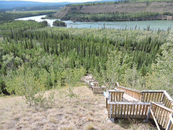
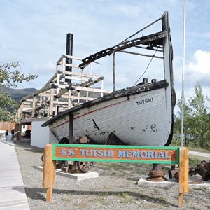
We left the campground rather late and our first stop was at the famous Five Finger Rapids that has a great lookout by the road and info plaques. The Yukon Territory spent a lot of money on the very well made and numerous information plaques all over the place. Thanks Yukon! The Keno Sternwheeler parked in Dawson City went thru these rapids on its final journey. Imagine a sternwheeler going thru rapids. Well they did tie cables to it to control the boat's movement. Still a lot of extra work.
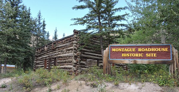
The next stop we made was at the historic Montague Roadhouse that was built way back after the gold rush days and was a stopping point for weary travelers. The building was missing its roof and second floor. It's been here for a hundred years, but who knows how long this thing will last in the weather. The walls are made out of very large logs and there is no floor, windows or doors. A real fixer-upper.
It was now about six-thirty and we stopped by Braeburn Lodge to pick up one of their famous cinnamon buns for breakfast tomorrow morning and then some. This bun is huge! It's about 3 inches thick and 10 inches in diameter and only cost ten bucks Canadian which translates to about eight bucks U.S. Still a hefty price for a cinna-bun.
Down the road we found Fox Lake campground which is a Yukon Territorial park on Fox Lake and we picked out lake frontage sites. Just another best-ever campsite. Now, this is rustic camping two days in a row. Diane and I love it. It was a breezy sixty-one degrees while we ate a rather late dinner at nine o'clock by the lake with a nice campfire and a game of cribbage that I lost, again. A Sam Adams went very well with my dinner. The breeze died down a lot and the campfire kept us warm. Wonderful camping in all ways. It'll be chilly tonight with partly cloudy skies.
It is 59 degrees outside at midnight Pacific time.
Day 70 ~ Tuesday, August 11 - The skies are bright with heavy duty clouds that make it look like it could rain any minute. The temperature got down to fifty degrees last night and has warmed up to sixty-three by eleven o'clock. I hated to disturb the silence here, but I had to run the generator a little after nine for about an hour. The campground is now quiet again except for the occasional vehicle on the nearby highway.
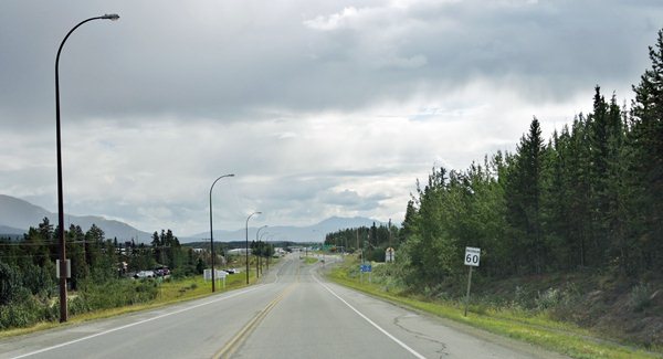
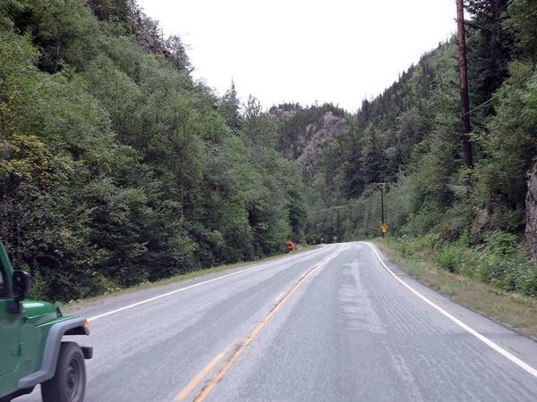
We hung around our Fox Lake campsite until late because it was so very beautiful there, but a cloudburst brought us quickly back to reality and we're back on Highway 2 heading south. Highways are supposed to be hard surface roads. This one is not. The Klondike Highway is only partly hard surface and mostly washboard gravel with no shoulder and LOTS of dust. Every time we stop, I wipe a gritty residue from every surface. It's getting really old. The scenery here is beautiful tho – moose habitat with lots of small, shallow pockets of water surrounded by high grass, birch forest and spruce mixed in. The leaves shimmer in the light breeze. Now small streams zigzag through the valley floor and of course, everything is surrounded by mountains. BTW: the mountains are very old and worn and are really big (really BIG) hills now. Long, narrow Lake Labarge is coming into view which means we're almost to Whitehorse which means civilization again – traffic, grocery stores and laundry facilities AND possibly a Wi-Fi connection. We'll keep our fingers crossed.
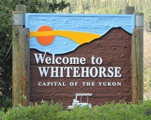
Well, the weather is as changeable as the scenery. We're driving through cloudbursts interspersed with patches of sunshine and the valley has narrowed so we only see rolling foothills and now we have tan/gray bark of Aspen mixed in with the white, white birch or maybe it's just the dust from the road blanketing some of the trees. Just passed a toboggan decorating the entrance to a home site. We're very close to Whitehorse. The road has become smooth and blacktopped. We passed a horse ranch with goats and sheep and LLAMAs!?! Wow. Llamas hail from the Andes in South America so they're probably well-suited for this climate – just never considered they'd be here. Streetlights – haven't seen them since Tok and painted lines on the road! Oh, yeah, big city ahead. Seventy-five per cent of the population in the Yukon Territory live in Whitehorse – all 30,000 of them.
There's a lot of scary driving going on here. Trucks passing on the uphill curves and lots of driving on the wrong side of the road – uphill, downhill, curves – doesn't matter. These people are fearless. Granted, there's not much traffic, but the odd chance that a vehicle should happen along at the wrong time is just plain dangerous. Alan took pictures of the cars going around us with the double yellow lines right there.
We paused briefly in Whitehorse and determined that we could get through Carcross, YT, to Skagway, Alaska, today. Back in the good old USA – YES! We are hoping the Verizon hotspot will work there.
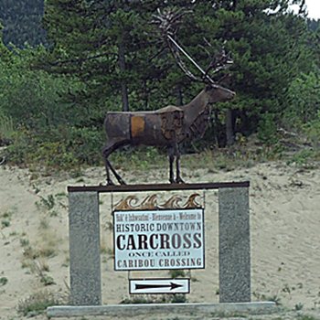
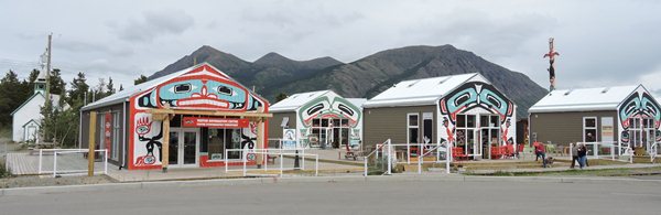
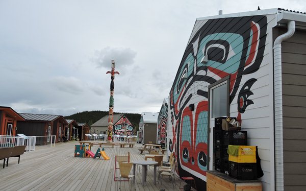
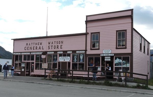
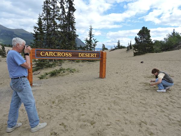
Just before Carcross, we passed through the Carcross desert – well, the sign says desert. This reminds me of Sleeping Bear Sand Dunes in Northwest Michigan. Didn't expect that. Sand and clumps of Spruce. A bit further, we found Carcross - a bunch of old buildings housing antiques, gift shops and ice cream parlors. The new Visitor Center area is painted up with native designs and totems and has electronic flush toilets - didn't expect that either. This is an area of extremes and apparently is a mandatory stop for tour buses - lots of tour buses loaded with senior citizens looking for ice cream. They're probably on a cruise ship tour from Skagway.
There is very little wealth here. No apparent industry. I don't know how the residents survive after the tourists go home. Maybe Canadian welfare helps.
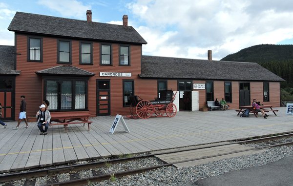
Most of the buildings in the tourist area look new because they are new. Google street view doesn't show a lot of them. The renovated railroad station has been here since 1910. You can book a beautiful scenic train trip from here thru the mountains to Skagway.
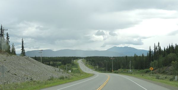
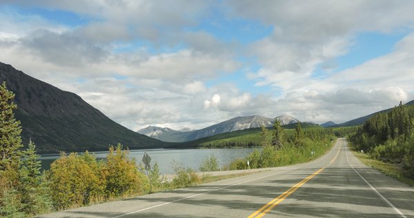
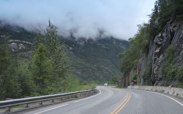
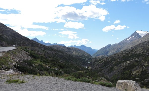
Just south of Carcross, the mountains look fake, mostly shale and not much vegetation. They're real and large and we're riding through a pass. They just look fake. There is lovely Foxtail Lake and the mountains seem to rise directly out of the lake - kind of like the Grand Tetons do only not as sharp ridges. We see the lake, the road, the mountains and the hovering clouds – quite a scenic drive. There are small whitecaps on the lake so we know the wind is picking up. What's this – an old sluice built from the roadway to the lakeshore. Neat! We're in avalanche country and you can see numerous rockslide scars on the mountains. Wow – there's a cloudburst ahead blocking out the view – looks like God set up a smoke machine. This is another simple ride in the Yukon. Oops. We're in B.C. now – just passed the welcome sign - and now we're into the misty rain, again.
The drive into Valdez was GORGEOUS (Did I mention that before?) and this one into Skagway ranks right up there. There's a cloud just hanging onto a white-capped mountain and wreaking havoc up there. We're happily in the sunshine, but climbing. Now we've rounded a curve and have a totally different landscape. Rocky mountaintops with no vegetation, tundra next to the road, permafrost and scraggly trees and now thick fog. Quick changes. We'll stay on our side of the road. I hope the locals do the same. They won't.
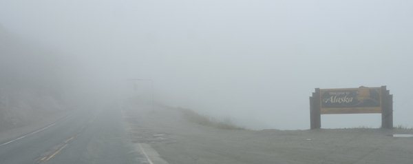
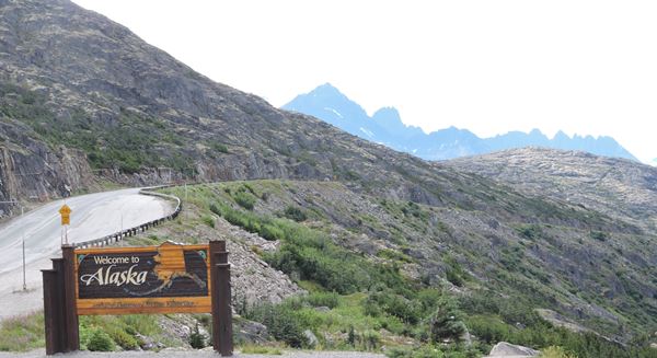
We drove thru the clouds with visibility down to a couple hundred feet. Now that we are above the clouds, we're approaching the Canadian U.S. border high in the sky. After we explained our short journey in Canada from Fairbanks, the U.S. border guard let us thru quickly. The fastest border crossing ever. He didn't even ask if we had ten thousand dollars in cash, or guns, or knives - their usual standard questions. Well, we are now back in Alaska for the last time on this journey and maybe our last time ever. The fog has become thick and heavy again and we can only see about 100 feet ahead of us. The mountains have disappeared and the view is nonexistent. There is only the white line on the side of the blacktop and we're grateful to have it as a guide. Oh, no - groups of bicyclists are on the road! Here? Now? We came close to an accident because the cyclists blend in with the fog. This is dangerous! We are driving about 15 mph coming out of the pass and have bicycles to avoid! This is a very dangerous stretch. As we descend, the fog dissipates a bit, but that was scary. We made it with no incident. Thank you, thank you, THANK YOU, LORD! Please bring those cyclists home safely as well. Alan thinks that all of these cyclists are brain dead idiots.
What yellow line? You can make it. We are on our way into Skagway on highway 98.
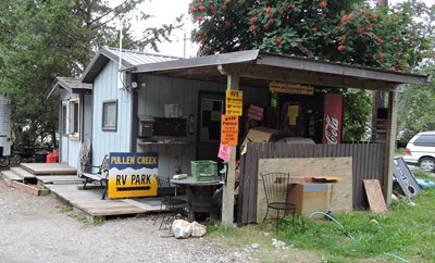
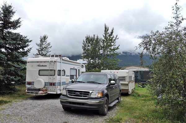
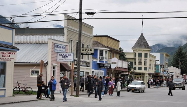
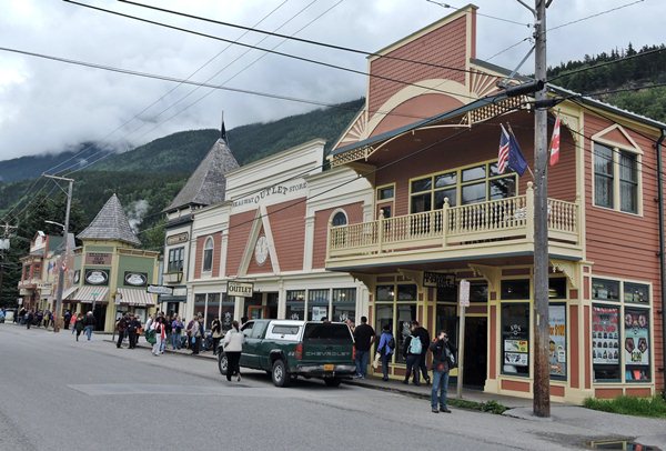
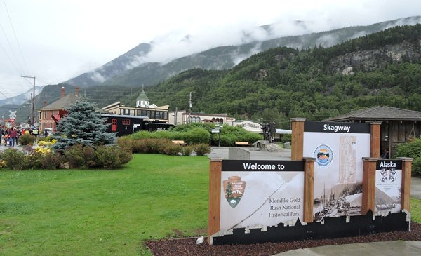
We are not far from Skagway and this scenic drive is spectacular to say the least especially with the clouds just hanging over the cliffs. Over the hill and around the bend and bam we are in Skagway with people walking all over the place. It is a very busy tourist town with at least four cruise ships parked here every day. We booked in for two days at Pullen Creek RV Park at the edge of downtown Skagway, Alaska, close to the cruise ships. This place is just another crappy campground with dirty restrooms and pay showers that are anything but hot. The upside is that it's just a short walk to downtown and the railroad station and right next to Pullen Creek and Pond with one heck of a lot of salmon trying to swim up the creek and spawn. This activity kept us interested for quite a while watching the fish in the pond jump two feet into the air and make a big splash. They're probably jumping for their last meal because they will die shortly after spawning. This is fascinating!
We walked downtown after the cruise ships left, did some window-shopping and had a late dinner at Northern Lights Pizzeria for almost fifty bucks for two - not cheap. It is a very chilly 60 degrees outside with a bit of a breeze and overcast skies. It rains a LOT near the water in Alaska. Right now, we get a break as we walk back to the campground and put an end to our busy day.
It was warmer last nigh and only went down to 55 degrees outside with very overcast skies.
Day 71 ~ Wednesday, August 12 - Heavy overcast skies with 62 degrees at nine o'clock Alaska time and that was the high for the day. We had sprinkles all day; not a real rain. Alaska time is 4 hours difference from EST and there is a part of Alaska that is on Hawaiian Time at 5 hours difference.
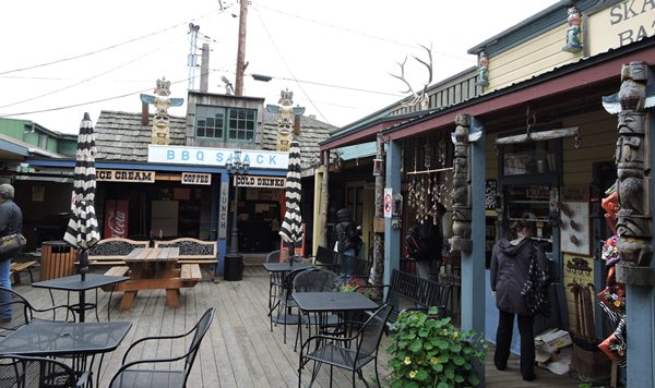
We walked around downtown Skagway with all the tourists from the five cruise ships that were anchored close to the campground. ALL of the shops were CROWDED and there are a LOT of shops. This is like Mackinaw Island on steroids with diesel fumes from the damn buses.
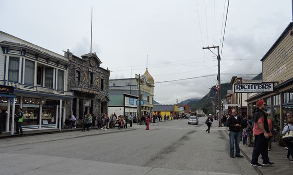
This is a tourist town.


Lunch was at the BBQ Shack in an alcove bazaar off the main street. It was quieter there and we sat in an atrium away from the masses. Wonderful. We learned that caribou is much leaner than bison which is much leaner than beef and is much more expensive too - at around $20 per pound. Alan and I shared a 1/3 pound caribou burger with a side of baked beans for $13.00 American. Delicious!
Later, we stopped for an espresso at the train station and met some interesting folks from Kansas. They wanted to know where they could sit and wait for the train as they had purchased tickets for the White Pass Summit Excursion train ride that leaves at four-thirty. They chose to sit with us a bit and before the conversation ended, we decided to take the train ride too. This was something Alan had been talking about since December but we didn't think we could afford it. Well, my Dad extended some spending money before we left home and we dipped into that stash - grateful for his generosity.
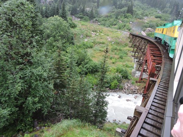
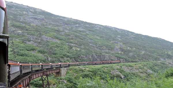
The train is a narrow gauge railroad and only 36" between the rails, but has the look and feel and sway of the full size version. It climbs nearly 3000 feet, 40 miles round trip from Skagway through White Pass in British Columbia and back. The weather is clearer today and the views are terrific and a tour guide narrates stories, history and points of interest along the ride. Alan was in and out of the railroad car like a rabbit, standing outside on the apron and braving the misty rain and chill of the mountain air for the perfect picture. I was warm and dry inside looking through the large windows and listening to the narrative.
I met a young gal from Washington. Her family was on the cruise ship but she was just with her Dad for the train ride. She was fighting cancer and faced multiple debilitating side effects. She and I sat together for a bit as we went through the two dark tunnels. I also befriended two couples from California from a different cruise ship who became fascinated with our journey and may try camping to Alaska next year. I warned them that camping - even in a rented motorhome - is definitely NOT the luxury trip they're taking this year. I wished them all well as we parted.
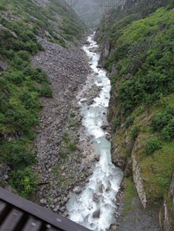
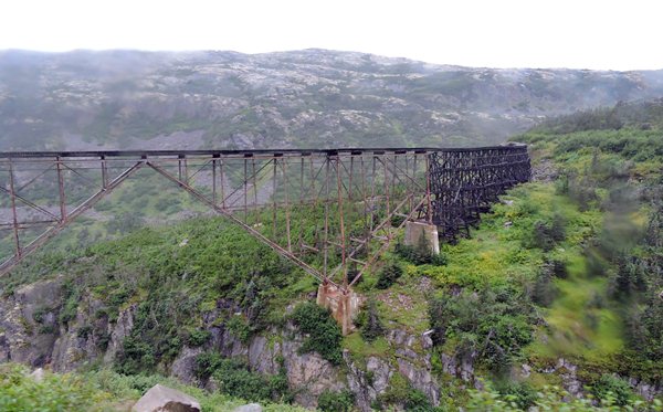
That's a small river running down the canyon under this new bridge and the old trestle.

WPYR Train Ride Back to Skagway
This video is 2 minutesand 6 seconds long
Here we go! We are way up in White Pass heading back down to Skagway.
I was standing on the outside platform leaning over the side to take pictures on the way up.
On the way down, I was on the same platform with nothing to block our view out the rear of the train. The videos are pretty cool.
WPYR Train Ride Back to Skagway
This video is 3 minutesand 39 seconds long
We went thru a long tunnel which is always cool and then a bridge. This video shows the old trestle that is in the picture on the top left
WPYR Train Ride Back to Skagway
This video is 1 minuteand 18 seconds long
...and there was one more tunnel with a trestle at the entrance to the tunnel.
This was a cool train ride.
Dinner in our trailer was Salmon and peppermint Schnapps for Alan with chicken and tea for me along with pierogies, fresh green beans from the Dawson City Farmer's Market and a fresh green salad. Yum!
It is 57 degrees outside at 9:00pm Alaska time with heavy overcast skies, again.
Day 72 ~ Thursday, August 13 - Here we are in Skagway, Alaska, and the skies are clear and sunny, but cool. I checked our new Walmart indoor/outdoor thermometer with memory and it says it went down to 45 degrees last night. Chilly. The Disney cruise ship is in port along with 3 other ships this morning. We have to leave.
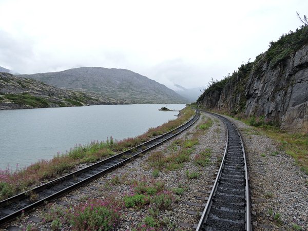
After topping off the gas tank, we headed north on Highway 2 - the same highway we came in on. Many Alaska tourist towns have one way in and the same way out. Crazy, but easy to navigate. Can't get lost. What we missed on Tuesday due to fog, we are seeing in clear detail today. Leaving Skagway, we drove back up White Summit Pass at 3292 feet. The scenery is surreal – mostly rock with a very few stunted trees. The treeline is low here and the mountains look fake again, but the skies have only puffs of clouds. The BC sign is made of rock piled to look like a human only about 10 feet tall. We've seen rock cairns piled everywhere so why not capitalize on it? There's a short clump of fuchsia colored Fireweed hugging the edge of the roadway. This area is quite beautiful in its own stark way. We'll be approaching Canadian Customs shortly. Same questions most every time. We're not worried. The truck tells us it's 56 degrees outside, but it feels like 40. We're in the valley now with mountains surrounding us and the little lakes and ponds are full of glacial silt giving them that beautiful turquoise color.
Say Goodbye to Alaska
We're through customs and into the Yukon Territory, Canada, on our way north toward Carcross and then Whitehorse for decent but pricey internet connections since I need to work. We can imagine the miners walking this area in the 1890s – tough, rugged men. They had to bring one ton of supplies with them into the Yukon. That meant hauling what they could up and over the Chilkoot Trail to the pass and then going back for the next load about 40 or 50 times and then moving on to the next section. Some were fortunate to have pack animals, but many simply hiked with huge packs. This area today is a rough hike and we have many wide and improved trails. They didn't have those conveniences – makes you think.
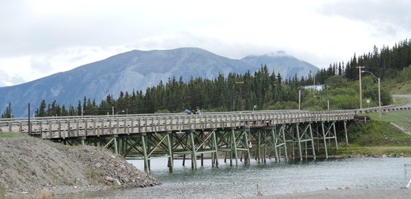
At km 47.7, the Yukon Suspension Bridge spans the disjointed river we've been following, but admission is $14.00 to walk around 100 feet. We decided to pass. Besides, we don't like the height.
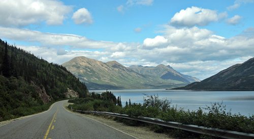
We're in and out of avalanche areas since the highway clings to the edge of the mountains and it's easy to imagine what this looks like in winter. The end of Tutshi Lake has come into view and it must be deep due to the deep green color. It's big – about 18 miles long and a mile wide and we keep catching glimpses through the tall Spruce forest. No boats. No commercialism. Just the mountains, trees and lake – lovely - and now some of the mountains are snow-capped. At this lower elevation the fireweed has finished blooming and gone to seed and it blows with the wind like dandelion seed.
There's very little traffic and we pass on-coming tour busses and campers about every couple miles. There's no local traffic in sight although Skagway was mobbed with people. There were 4-5 large cruise ships anchored at the deep water dock each day. They all left by 8 PM and most shops closed by 7. The railroad also brought it's share of tourists every day, but also took some away as it left the station. And let's not forget about the buses.
We stopped at Bove Island Rest Area for some picture time, then Carcross for maps from the Visitor Center and breakfast scones from a sourdough bakery. Carcross desert caught our attention again for more pictures. Then we stopped by Emerald Lake aptly named for its lovely emerald color. The rest area was high above the lake and we took lots of pictures. The road to Annie Lake was 10 miles of gravel, but the view when we arrived was breath-taking. Diane said she could live there for awhile IF Canada would sell the Yukon to the US. Gregg and Gale spotted a large porcupine taking a bath and Diane thought she saw a bear too (after contemplation, it could have been the porker).
We finally arrived back in Whitehorse, or close to it, and stopped at Hi Country RV Park for the night and all day tomorrow so Diane can work. This campground is only a couple miles south of Whitehorse. We were so excited to get one-half hour of free Wi-Fi, we just jumped for joy. Wi-Fi for tomorrow will cost us eight bucks for a 24-hour period. I'll bet you complain about the cost of your internet for a whole month. Eight bucks a day would put us at $240 for a month. Canadians know how to make money. We have heard all of the bull about how much it costs to bring the signal way up here. Right! Pay-by-the-mile internet.
It is 52 degrees outside at 11:30pm Pacific time with cloudy skies.
Day 73 ~ Friday, August 14 - It is a chilly 54 degrees under very nice sunny skies this morning. Breakfast was scones that we procured from the bakery in Carcross. Very good. Diane has to work today, so we set up the equipment in the trailer and bought a day's worth of Wi-Fi for eight bucks. All seems to work quite well. For eight bucks, it should. I had to rearrange the back end of the truck to accommodate all of our souvenirs, rocks, sand samples, diamond willow stalks from Fairbanks and driftwood from Homer.
Diane reports that the Wi-Fi keeps disconnecting her from the internet, so the Wi-Fi sucks for eight bucks. She did get her work done, but it took longer than it should have. The Wi-Fi is supposed to be free for one-half hour for each device each day of our stay here. Big lie. Use it once and that's it for that device forever. More marketing BS. I'm getting real tired of Canada. Oh, and the Wi-Fi service in Skagway is all owned by the electric company who doesn't allow any competition to come in there. Make the internet too expensive to keep the people dumb. Food is expensive, gas is expensive and the internet is really expensive. And the funny thing is, all of the residents up here know this. Crazy. Everything north of the border is crazy. But, the scenery is gorgeous, in most places.
Well, it's 73 degrees at 4:40 in the afternoon under sunny skies and I just spent the day finishing this log up to here and adding pictures for the week; a time-consuming job. Yes, pictures! We plan on staying here in Whitehorse for one more day to see the town and its attractions tomorrow. We didn't go anywhere today because I have a cough that's been going on for a few days now and I feel kinda crappy. So we had dinner on the picnic table, watched some old TV shows, I took a shower and went to bed somewhat early after a nice glass of Peppermint Schnapps. Good for what ails you.
It went down to 43 degrees last night. The skies were clear.
Day 74 ~ Saturday, August 15 - We woke up to sunny skies and by noon the temperature rose up to 62 degrees getting to 78 in the afternoon. We are out of food for breakfast. We must hit the grocery store today. Diane made pancakes from a mix that doesn't require an egg or milk, just water. Pretty good with a couple strips of bacon. I have orange or grapefruit juice every morning with my assortment of pills. Today is beard trimming day and time to refill the seven-day pill container. All good for another week in the wild north country.
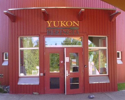
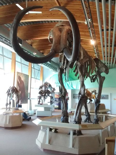
Whitehorse, here we come. First on our tourist list was the Yukon Beringia Centre. And we all ask, "What the hell is a Beringia?" I sure didn't know and now I do. Okay, twenty-thousand years ago during the ice age, you know, the one that the animated movies were all about with Manny the mammoth, the oceans were really low because the water was contained in the glacial ice that covered a lot of land. Take away five-hundred feet deep of ocean water and you have land that stretches from Alaska to Russia. We all know this. This chunk of land is called the Beringia. Well, this Yukon Beringia Centre has all of the information on this with a bunch of skeletons of the animals that walked thru this area. The displays are very educational and set up for school-age children and there is a theatre showing movies for those of us that can't (or don't want to) read. Really cool stuff. We are so much smarter now. We'll forget it all by tomorrow because we are old.
Outside - This is what happens when the local hardware store has a sale on red paint.
The world's largest weather vain, which is really just an airplane up on a pole and allowed to rotate in the wind, was sitting right next door and close to the highway. It really does work; we saw it move a little with the changing wind. We have seen some of the craziest stuff north of the border. All over up here in Canada and Alaska, crazy stuff.
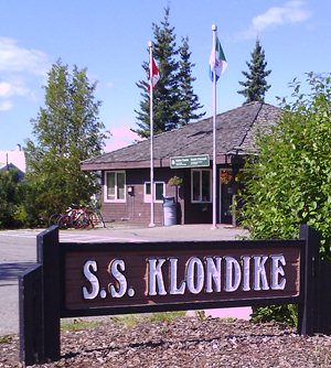
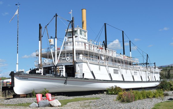
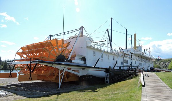
We toured the SS Klondike – the sister stern-wheeler to the SS Keno we saw in Dawson City. This boat is just a bit larger and was built to carry cargo / supplies up and down the river. Dawson City needed booze to outfit the saloons as well as food and mining supplies and everything else necessary to sustain life in the wilderness. Times were rough and the rivers were the main means of transportation and only lifelines to civilization until the road was built. The layout of the ship is much the same as the Keno only a little more spacious. The Keno is like our 15 ft trailer as opposed to a much more spacious Klondike similar to a 17 ft trailer. It was recently refurbished, freshly painted and the salon was appointed with tablecloths and place-settings, the galley with pans and spices sitting about and the cabins with bed-linens and clothing. These decorations gave us a much better vision of the lifestyle and comfort afforded by the boat.
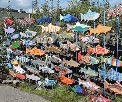
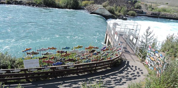
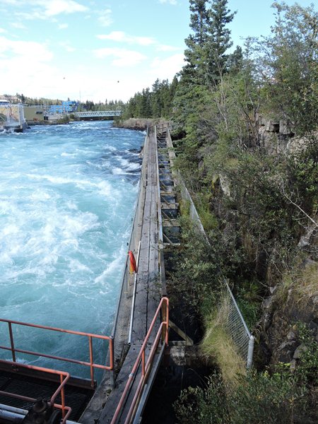
Next on our list was the world's longest wooden fish ladder which makes it possible for the fish that need to swim up the river to spawn to get around the damn dam built by the power company across the Yukon River. Yes, this ladder was loooong and there were very large, tired Chinook Salmon making their way up the river and above the dam to spawn. They were coming from the Bering Sea and had traveled over 2,000 miles up the river. They looked tired. All they had to do was spawn and then die. They actually looked half dead already.
We crossed the bridge again to see the Old Log Church and the sky scraper log cabin – a four-story log cabin. Imagine that! We were done with our list of attractions and in need of food, so stopped in at Tim Horton's for a bowl of soup and half a sandwich for dinner. Then on to the smallest WalMart we've ever seen. Too small for us and no fresh produce. We searched and found a Canadian Super Store with a large produce section, fresh meat and large dairy area. Good choice and we loaded up 4 small bags of groceries for over $100. Well, we are in the north where everything has to be shipped in and this is Canada where we expect it to be a bit more expensive, but WOW. I better not burn anything.
We called it a day and returned to the trailer to put away our precious supplies. Alan's still fighting off something so we medicated him and made him retire early. Hopefully, he'll feel better tomorrow. The dish of Häagen-Dazs coffee ice cream helped a lot.
It is 57 degrees outside at 11:00 pm Pacific time with clear skies, again. Wow!